Is a Hobe Sound waterfront home calling your name? The views and boat days are incredible here, but the best first move is to confirm that a property fits your vessel, your lifestyle, and your long-term plans. In this guide, you will learn the essentials that matter most at the shoreline: water type and access, depth and bridges, docks and seawalls, permits, insurance, and a focused buyer checklist. You will walk into your first showing knowing exactly what to ask and what to verify. Let’s dive in.
Know your waterfront type
Hobe Sound offers three primary categories of waterfront, each with distinct benefits and responsibilities.
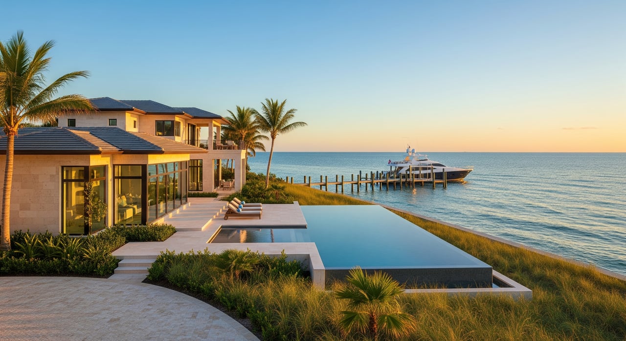
Oceanfront on the Atlantic
Oceanfront properties sit on the barrier island with direct Atlantic exposure. You get sweeping views and beach access. You also sit within a dynamic coastal system that can involve dune management and the state’s Coastal Construction Control Line program. Shoreline work typically requires state review, and you should understand how storm events and beach projects may affect your plans.
Intracoastal and lagoon frontage
Many homes front the Indian River Lagoon and the Intracoastal Waterway. These protected waters are prized for boating, paddle sports, and sunset views. Navigation follows marked channels within a shallow estuary shaped by seagrass beds and shoaling. Your route to the ocean depends on depth at low tide, bridge clearances, and the nearest inlet.
Canal-front homes
Canal-front neighborhoods can deliver private dockage and calmer water. The tradeoff is that canal depth, width, and turns can limit the size of the boat that can transit safely to a main channel. Verify dredging history, low-tide depths, and any shared maintenance obligations for seawalls or canals.
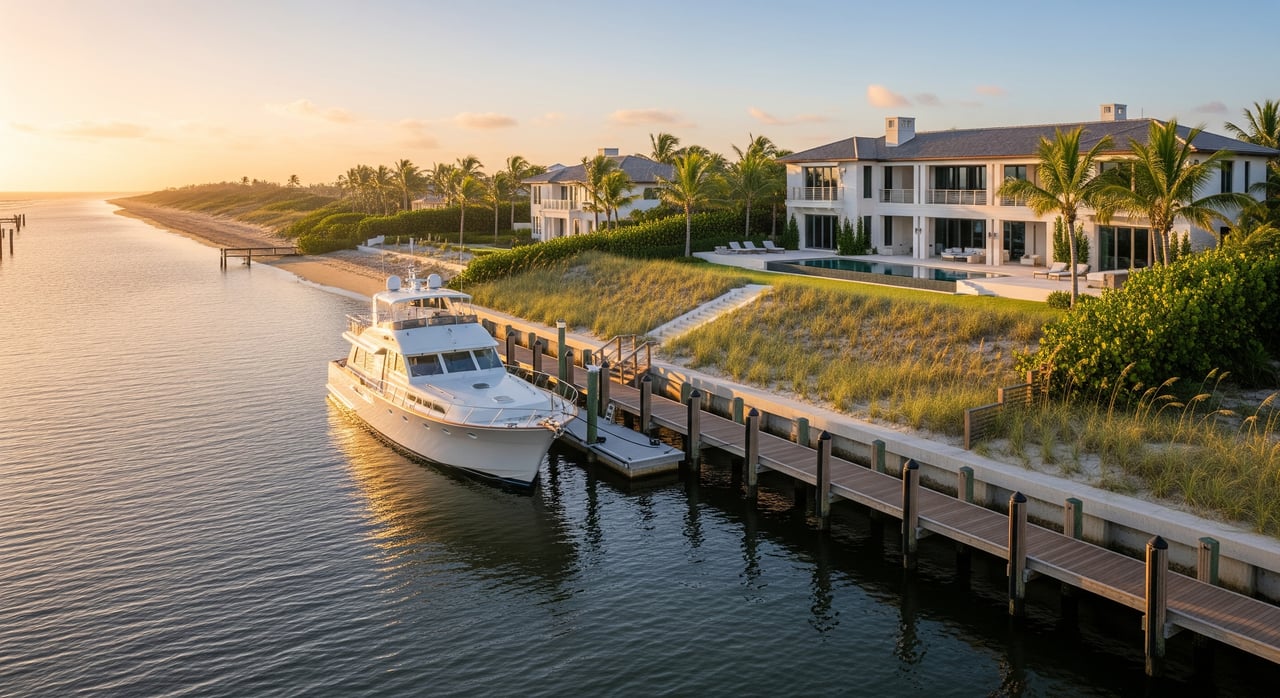
Ocean access and nearby inlets
Hobe Sound sits between two major ocean access points. To the south, the inlets around St. Lucie and Jensen Beach connect to the Atlantic. To the north, Jupiter Inlet serves much of the regional boating community. Your practical route depends on where your property sits, the marked channels, and your boat’s draft and air draft. This is why charted depths, tide timing, and bridge clearances matter before you buy.
Depth, tides, and shoaling
The Indian River Lagoon is a shallow, living estuary. Depths are charted relative to mean lower low water, which reflects minimum expected water at low tide. While daily tides are modest here, seasonal king tides, strong winds, or storm surge can raise or lower water levels. Before you offer, confirm the water depth at low tide along your route and at the dock. If needed, commission a local captain or marine surveyor to run a low-tide check.
Bridge clearances and routing
Bridge clearances control which boats can pass. Published numbers are tied to a datum and real-world clearance changes with the tide. If your route includes movable bridges, verify opening schedules and any restrictions. For a precise fit, match your vessel’s air draft to the lowest clearance along the path from the dock to the ocean, and confirm using current charts and local notices before closing.
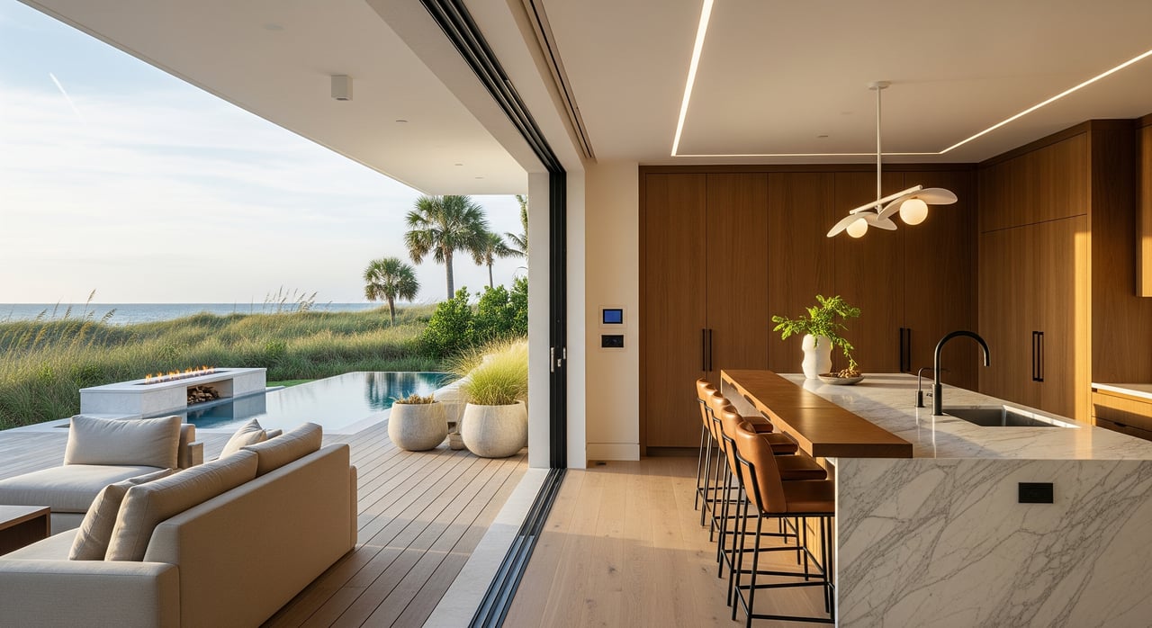
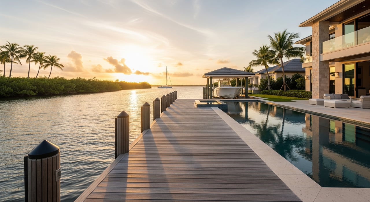
Docks, lifts, and shoreline basics
Dock types and tradeoffs
- Fixed-pile docks are common and sturdy but less forgiving with water-level changes.
- Floating docks ride with the tide and can be helpful in variable depths.
- Boatlifts keep hulls clean and safe, but add permitting, power needs, and ongoing service.
- Davits and mooring pilings are alternatives where lift placement or depth is limited.
Choose materials and hardware designed for saltwater, and budget for periodic servicing of lifts and fasteners.
Seawalls, riprap, and living shorelines
You will see seawalls, rock revetments, and, in some areas, living shoreline installations that combine vegetation and natural materials. Shoreline work usually triggers permits and may involve state and federal review when it affects navigable waters, wetlands, mangroves, or seagrass. Ask for as-built drawings and permits so you understand what is legal today before you plan any changes.
Maintenance realities
Salt, sun, and storms drive lifecycle costs. Expect inspection and replacement of piles, decking, and fasteners over time. Look for signs of seawall distress such as leaning, cracking, or scour. A pre-contract marine inspection can save you from surprises.
Permits and protected resources
Waterfront changes are highly regulated to protect sensitive habitats such as manatee zones, seagrass beds, and coastal dunes. Most new docks, dock extensions, lifts, seawalls, dredging, and mangrove trimming require permits. Agencies commonly involved include Martin County departments, the Florida Department of Environmental Protection, and the U.S. Army Corps of Engineers. Wildlife considerations often involve the Florida Fish and Wildlife Conservation Commission. Timelines vary by scope. Small repairs may be approved in weeks, while new structures or dredging can take months and may require mitigation.
Flood, wind, and insurance
Many waterfront parcels fall within FEMA flood zones such as AE or V. Elevation and construction details influence flood insurance costs, and an elevation certificate is often needed for quotes. Windstorm coverage reflects roof, openings, and structural protections. Ask for recent insurance quotes and any wind mitigation reports so you can budget realistically. If you plan to insure docks, lifts, or your vessel, confirm policy terms and storm-season storage requirements.
HOA and neighborhood norms
Some waterfront neighborhoods use HOAs or deed restrictions that limit dock dimensions, boat types or sizes, and overnight mooring. Shared seawalls and canals can come with cost-sharing rules. On the water, you will also see posted speed limits, manatee zones, and no-wake areas enforced by marine patrol. Local rules on lighting and noise can affect how you use the dock at night.
Services and utilities at the dock
Confirm power supply at the dock, including pedestal type and capacity. Check for potable water and any pump-out connections. Proximity to fuel, haul-out, and repair services matters. Availability varies along the lagoon, so evaluate travel time and access for routine maintenance.
First-look buyer checklist
Use this shortlist before touring or making an offer:
Property and legal
- Recent survey showing mean high water and upland boundaries.
- Recorded permits and as-built plans for dock, lift, and seawall.
- Title and deed confirming riparian rights and any easements.
- HOA covenants and rules covering docks, boats, and shoreline work.
Navigation and physical facts
- Verified low-tide depth at the dock and along the route to the channel.
- Distance to the marked channel and to the nearest inlet.
- Lowest bridge clearance along the route, including movable bridge schedules.
- Presence of seagrass, oysters, or protected habitat near the dock.
Permits and compliance
- Copies of active permits and documentation of past shoreline or dock work.
- Any open code enforcement items or notices.
- Canal or channel dredging history and who paid for it.
Flood, wind, and insurance
- FEMA flood zone designation and an elevation certificate if available.
- Sample quotes for homeowners, flood, and windstorm coverage.
Dock utilities and nearby services
- Electric capacity, water, and any pump-out details at the dock.
- Proximity to fuel docks, haul-out yards, and marine mechanics.
Condition on site
- Dock structure, pilings, cross-bracing, decking, and hardware corrosion.
- Seawall condition including any leaning, cracking, or undermining.
- Mangrove presence and shoreline stability.
Smart next steps
- Confirm depth, bridge clearances, and tides using current charts and a low-tide run if needed.
- Request survey, permits, and HOA documents before you schedule a second showing.
- Obtain insurance quotes early, using an elevation certificate when available.
- If you plan changes, schedule a pre-application conversation with Martin County and consult qualified marine contractors.
- For a design-forward plan, align dock and shoreline updates with your architecture, landscape, and lifestyle goals.
When you are ready for a confidential conversation about the right Hobe Sound waterfront fit, connect with a local advisor who lives the boating lifestyle and understands design, construction, and permitting. Reach out to Susan Turner for discreet guidance and access across Jupiter Island and Hobe Sound.
FAQs
How do I confirm ocean access for my boat in Hobe Sound?
- Verify low-tide depth at the dock and along the route, the distance to a maintained channel, and the lowest bridge clearance to the nearest inlet before you buy.
What permits are needed to add a dock or boatlift?
- Most new docks, extensions, lifts, and seawalls require permits from Martin County and the Florida Department of Environmental Protection, and often federal review for work in navigable waters.
Who pays for seawall or canal repairs in a neighborhood?
- It depends on recorded easements and HOA documents; many communities outline cost sharing for shared seawalls and canal maintenance.
Are manatee zones and no-wake areas common near homes?
- Yes, you will see posted speed zones and no-wake areas in the Indian River Lagoon to protect wildlife and shoreline, and they are enforced by marine patrols.
Will flood and wind insurance be higher on waterfront?
- Waterfront homes often carry higher premiums due to flood and wind exposure; elevation, construction features, and wind mitigation measures can improve pricing.